Very
Early Photographs
of
TORQUAY
Taken
from stereoscopic views & CDVs
A
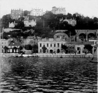
very early view, pre 1864, looking from Rock Walk towards Vane Hill,
the terrace in the foreground is Palk Street with the single storey
“Marine Tavern” Note bottom right is still a small area
of foreshore- eventually the Pavilion would be built here on
reclaimed land. In the centre is the Strand, Victoria Parade,
slightly up the hill is Park Terrace, and, to the right only Park
Hill villa is built on the hill (see below)


Taken
from a CDV by Way & Sons of 13 Victoria Parade, this picture
dates from between 1864 and 1867. The 1864 date is from the date of
building of the very top right hand villa on the hill, and the 1867
date is from the date that they started to cut away the rest of
Beacon Hill to build the ballroom, the rock removed being used in the
construction of Haldon Pier
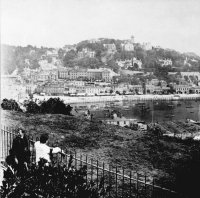
Again
taken from a CDV by Way & Sons, and photographed from a very
similar position to the one above, the date being around the same
period of 1864 to 1867. This shows the Strand and The Terrace as well
as many of the villas built on Lincombe Hill.. Note the lovely gas
lamp fitted on the top of the wall. The big house in the centre of
the picture is Apsley House (see advert
on my 1878 adverts page)
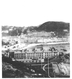
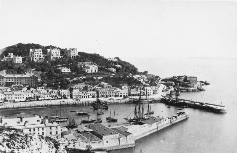
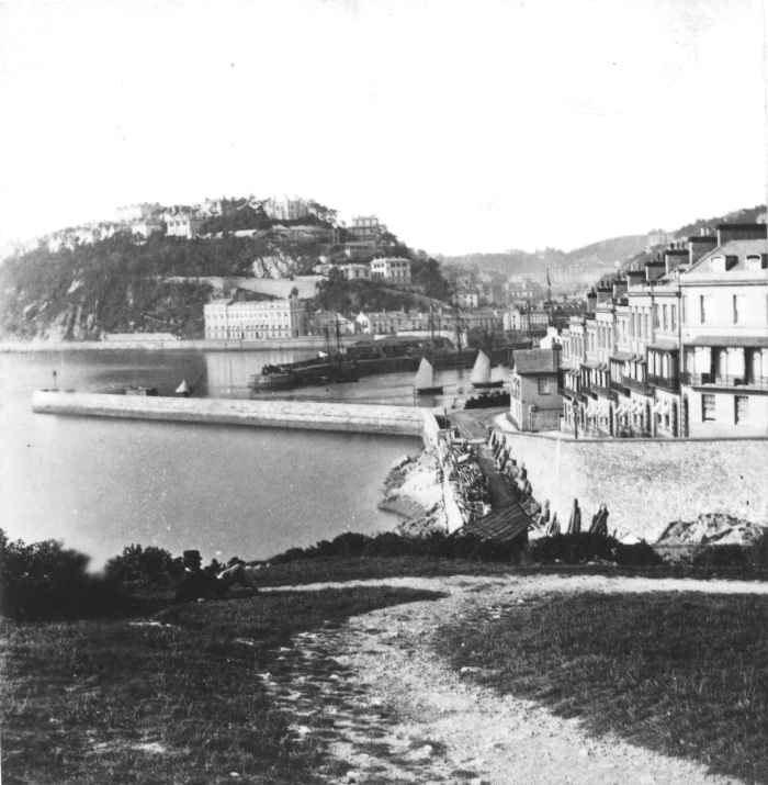
This
view can be dated between 1859 and 1867, and shows the harbour
looking from Beacon Hill, the terrace of houses on the right is
Beacon Terrace. The roadway in the centre of the foreground is
leading to Shaws Shipyard and is where Beacon Quay would eventually
be built. The hill in the background is Warren Hill, the large
terrace, centre left, on the waters edge is Sulyarde Terrace, to the
right of this would be built the Torbay Hotel and this would
eventually take in Sulyarde Terrace

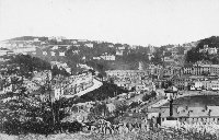
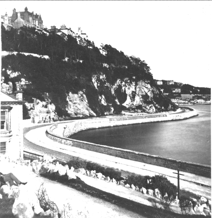
Again
dated from the early 1860s, this view is of the new road that was
built around the bottom of the cliff to give easy access to Torquay
harbour from Cockington and the growing district of Chelston, in 1858
it was renamed Station Road to commemorate the opening of Torquay
Railway Station. The houses on the top of the hill are on Waldon Hill
and this is an opposite view to the one above, from Beacon Hill.
Today, we have the Terrace gardens at the foot of the cliff and major
reclamation on the seaward side. The road today is known as Torbay
Road. The building on the extreme left is the end of Abbey Crescent-
still standing although much altered and subject to possible
redevelopment.

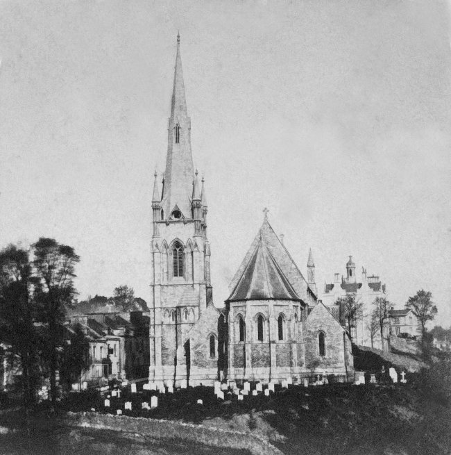
Church
of St Mary Magdalene, Upton Parish Church, from a printed stereoview.
Date unclear but certainly before 1891. In the background to the
right is the original Torbay Hospital, and a house called "Elm
Villa". To the left are the houses of Higher Union Street.

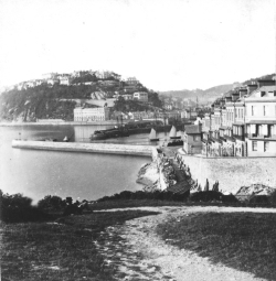
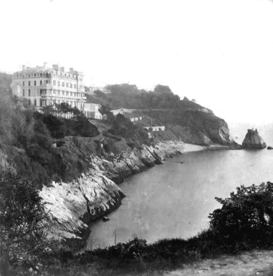
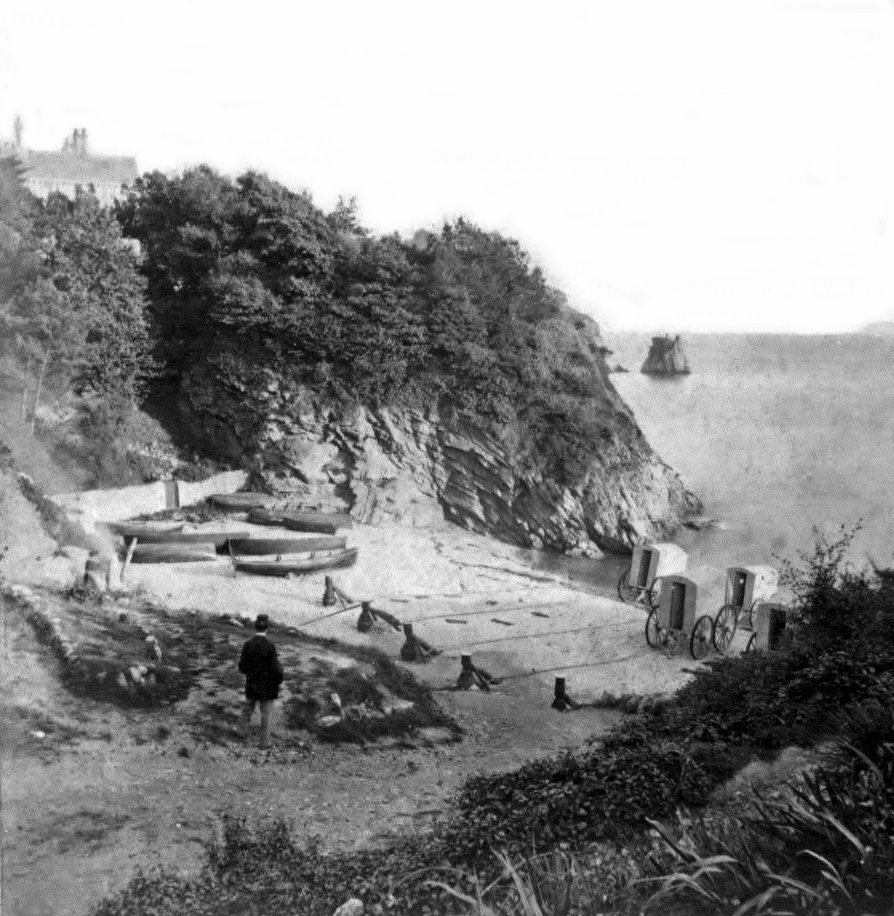
A
nice early view of the Ladies Bathing Cove, later known as Beacon
Cove, date probably between 1866 and 1871, in 1876 Torquay Lifeboat
station was erected on the extreme left hand side, after the lifeboat
was removed in 1923 this served for many years as a wonderful beach
cafe, until it was demolished to make way for the great white
elephant known as Coral Island (luckily now only a memory)
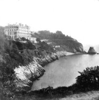
The
Imperial Hotel, Torquay, built in 1866 just around the corner from
the Ladies Bathing Cove (above). It was enlarged greatly in 1871 by
the addition of an extension built on the left hand side. Although
remodelled and extended it is still Torquay's leading 5 star hotel,
and ambitious plans are afoot to replace it with a completely new
complex
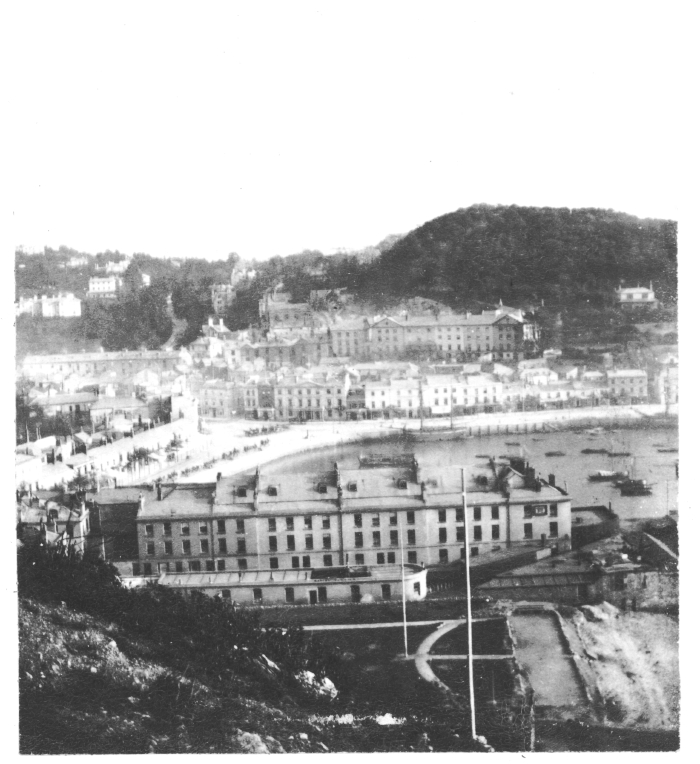
A
great view taken looking across the inner harbour towards Vane Hill,
possibly by Alfred Seaman, probably dated between 1887 and 1902.
Another
view possibly by Alfred Seaman, again dated between 1887 and 1902
looking out from Waldon hill over the harbour to Vane Hill (dating
source – the jubilee lamp on the Strand erected for Queen
Victoria's Golden Jubilee can just be made out)
To
Return to Front Page


